In Part 3b of our climate series, we explore the science, the stories, and the solutions that confront environmental justice and public health inequities in the Potomac River region.
The rapidly heating climate is an emerging public health crisis for the communities of the Potomac River region.
Our warming climate disproportionately affects the health of those who are most marginalized in our communities. To understand how the climate’s health impacts are unjustly distributed, we explore the history of the environmental justice movement and how communities of color in the Potomac River region are fighting to protect their health against pollution and climate change.
Climate resiliency is a steeper climb in some areas of the Potomac River watershed than others. This isn’t an accident.
In 2015, the Community, Engagement, Environmental Justice, & Health Center (CEEJH) partnered with the Anacostia Watershed Society to survey contaminants found in fish in the Anacostia River. They were concerned about the exposure of Anacostia recreationists to water contaminants from Pepco’s Benning Road facility, as well as other legacy pollution sites along Washington DC’s southeastern river.
They were particularly concerned about the health of low-wealth community members who fish the Anacostia to supplement their diet with missing sources of protein.
Throughout the US, communities of color and low-income communities are statistically more likely to have environmental burdens sited near them.
The Environmental Justice (EJ) movement brings attention to the fact that the people who suffer most from environmental pollution are those that our society has marginalized.
The EJ movement has deep roots in the United States that intersect with both the Civil Rights movement and the beginnings of the modern environmental movement that led to our foundational environmental legislation.
Many pinpoint the disaster at Love Canal as the beginning of a sequence of events that would spark environmental movements across the country. The dumping of toxic waste into an abandoned canal in the 1940s led to unexplained illnesses among Love Canal community members and eventually to the 1980 Superfund Act, which allows the U.S. Environmental Protection Agency (EPA) to investigate hazardous threats to public health and the environment.
Despite over a century of efforts from organizers and activists, people living in frontline EJ communities across the US still routinely have higher levels of cancer. Frontline EJ communities also suffer most from asthma attacks due to high levels of combustion byproducts being spewed into their air.
Climate Justice is the natural evolution of Environmental Justice
Just as with environmental justice, it is critical to note why climate justice issues are not a matter of happenstance. It is not a coincidence that the climate emergency is felt more acutely by some communities. This is the result of a western capitalist philosophy mixed with institutionalized racism: the result of a long history of policy and legislation designed explicitly to benefit White communities.
In the Potomac River watershed, the disproportionate burden on frontline Environmental Justice Communities is the result of not only our racist past (including intentional redlining), but also current permitting, zoning, and enforcement decisions that turn a blind eye to where pollution flows and who is exposed to it and lack consideration of cumulative impacts.
Local communities on the frontlines
Climate justice, done correctly, places those most impacted at the center of the climate response and demands that attention be placed on the frontline communities who are systematically rendered least capable of adapting.
Let’s take a look at a few frontline environmental and climate justice communities in the Potomac River Watershed who are fighting for their human right to a healthy environment.
Before diving into discussion of these communities, we’d like to make clear that Potomac Conservancy is a historically white-led organization and continues to have a primarily white staff and board. Our roots are not in these frontline communities and for this report we are leaning on the work and knowledge of others. As we work to diversify and use our platform to shed light on climate justice work within the Potomac River region, we acknowledge that our past work – and that of the environmental movement at large – may not have been in line with environmental justice principles.
Buzzard Point: “Clean this Place, Don’t Displace”
Buzzard Point lies in Southwest Washington, DC where the Potomac and Anacostia Rivers meet. The community is 83% African American and is facing a deluge of environmental hazards.
Increasing road traffic, concrete facilities, electricity generation from the Pepco substation, and the new D.C. United Soccer Stadium all spew dust and pollutants into the air, contributing to greenhouse gasses as well as high rates of cancer and asthma.
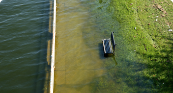
Furthermore, due to the increased intensity and frequency of rainfall in DC (see Part One), flooding from storm surge and rising sea levels are putting low-lying floodplain communities like Buzzard Point at risk.
To combat flooding, Buzzard Point is currently in the process of flood-proofing its infrastructure by installing flood walls, integrating a living-shoreline resilience buffer, raising new residential buildings higher above the ground, and upgrading old developments.
However, these giant, new residential units are displacing the low-rise homes and affordable private housing is dwindling in availability. Buzzard Point community members are concerned that once the neighborhood is flood-proofed and the toxins cleaned up, gentrification will push them out.
We have to fight to ensure this neighborhood remains mixed income and culturally diverse, 30 to 100 years from now.
Kari Fulton Near Buzzard Point Resilient Action Committee (NeRAC)
Organizers like Fulton and Rhonda Hamilton spearheaded a campaign to secure health safeguards for air quality and protect public housing in the changing neighborhood.
Brandywine, MD: An on-going fight to be seen and heard
Brandywine, Maryland is an unincorporated community with no town council or mayor. Its population is 74% Black. According to the CEEJH website , “This lack of political representation has led to Brandywine being exploited by County leadership and state officials to act as a dumping ground for industrial hazards and locally unwanted land uses (LULUs) and a sacrifice zone for the rest of Prince George’s County, the state of Maryland, and the Washington, D.C. region.”
Brandywine is plagued by three power plants within a 13-mile radius, one of which is a coal fired power plant. Additionally, two new gas fired power plants are being constructed within a three-mile radius. They also have a coal ash landfill (which sits by the community’s only playground), a sludge lagoon, a concrete batching facility, and a Superfund site. Additionally, there are numerous mining operations that utilize explosives to extract aggregate material for construction. Heavy traffic, including big diesel truck traffic, also bustles down route 301 past Brandywine every day.
The Be the Bridge Coalition, which is a community-based organization fighting for environmental justice, led by Kamita Gray has spent the last six or seven years trying to fight against the power plants, just trying to fight for the community to be healthier and more sustainable and to get rid of the pollution sources.
Along with the CEEJH Center, the team has performed health impact assessments, provided testimonies, and even submitted civil rights complaints to the U.S. EPA Office of Civil Rights. In addition, their air quality monitors consistently capture real time data on Brandywine’s air pollution that both threatens public health as well as contributes to the buildup of greenhouse gases in the atmosphere.
Testimonies provided by Dr. Sacoby Wilson, Kamita Gray, and other members of the community helped stop a special exception permit for the Brandywine Coal Ash Landfill. However, it was recently overturned in court, and must again be contested, noted Dr. Wilson.
Mount Clinton, VA: Finding solutions in the land
The New Community Project Climate Farm is an example of climate justice solutions led by those most impacted by climate change – in this case, immigrant climate refugees with traditional ecological knowledge of regenerative agriculture methods from their home countries. This intersectional project is a 6-acre agricultural research center for carbon farming and food production methods suitable to Rockingham County in the Shenandoah Valley of Virginia.
The farm’s coordinating team of five has developed a site plan for the 6-acre farm that will feature a variety of carbon farming methods: silvopasture livestock grazing, a multi-layer food forest, a forested streamside buffer zone with fruit-bearing pawpaw and persimmon trees and medicinal plants, annual-perennial regenerative cropping, multifunctional hedgerows, and a community garden for recent immigrants who lack access to farmland.
The team hopes to cultivate relationships with other landholders to establish land and water protections and regenerative agriculture beyond the boundaries of the farm. These exchanges will allow for rich learning, not only about land, soil, and ecological management, but also about the deeper social, emotional, and spiritual aspects of conservation that exist among various communities.
This is an excellent example of investing in an intersectional community-led project for climate justice solutions led by those most impacted.
Solutions: Policy and Investing in Community-Led Projects
Policy Solutions
Across all levels of government (federal, state, local), getting our society closer to environmental justice will require:
Laws that require environmental decision makers to think about environmental justice implications of their decisions and consult with affected communities before approving projects;
The full and meaningful involvement of those most impacted in decision-making processes; consideration of cumulative impacts of pollution;
Zoning law changes to prevent “sacrifice zones”;
And investing in communities that have been marginalized.
Locally, an EJ win was achieved when Virginia recently passed HB704 / SB406, which directs state agencies to examine the effects of proposed regulations on environmental justice and develop policies that advance environmental justice.
In August 2020, a group of Maryland environmental justice leaders wrote and submitted an EJ letter to Governor Hogan, which includes 22 specific EJ solutions for the state of Maryland to implement, under 3 overarching directives:
Maryland Department of the Environment (MDE) needs to have an Environmental Justice Plan
Maryland’s Environmental Justice and Sustainability Commission must be re-chartered
The Governor’s Office must show greater commitment to addressing systemic racism and advancing environmental justice
Invest in Community-Led Projects to Plant Trees and Food Forests
Funding the planting and maintenance of trees and food forests in historically redlined communities and frontline EJ communities will both address climate justice and capture carbon. We can plant trees in communities that do not have tree canopy to provide shade and reduce the heat island burden. Trees also filter pollutants from water, filter pollutants from the air and reduce carbon dioxide - the most excessive greenhouse gas.
“A lot of communities with climate change issues in urban areas don’t have tree canopy. It’s not enough to plant the trees, there have to be dollars invested to make sure there’s maintenance of the trees,” explained Dr. Wilson. “You know, a great thing you could do is to have folks living in the community get trained to plant the trees, do landscape design, and also landscape management. They’d also get paying jobs to do maintenance. So, they’d have ownership over it… it’s going to be more sustainable; it’s going to be better buy-in, and people will see the multiple benefits of having more tree canopy.”
One example of a bill that was recently passed to provide funding to plant and maintain trees is Maryland’s “Tree Solutions Now 2021” bill, which includes a provision creating dedicated funding of $15 million per year to plant and maintain 5 million trees in Maryland by 2031, including planting 500,000 trees in historically redlined urban communities.
Dr. Wilson noted that food forests in communities, “could address the stormwater runoff issue, the heat issue, the air pollution issue, the noise issue, and of course the food issue, right? Especially for folks in communities that don’t have supermarkets and grocery stores.”
Community, Engagement, Environmental Justice, and Health Center
In 2011, Dr. Sacoby Wilson established the Community Engagement, Environmental Justice and Health (CEEJH) Center at the University of Maryland (UMD), which is exploring, establishing, and promoting new climate justice solutions and action.
One huge focus of the CEEJH Center’s research is air quality monitoring and building networks of hyper-local air quality monitors using local sensors. Air quality monitoring is important because many communities in the region have poor air quality due to industry and traffic – especially in the Washington, D.C. metropolitan area where commuter traffic is common. Highways and byways disproportionately run through communities of color and low-wealth communities, causing the air to become saturated with combustion byproducts that pose numerous environmental and human health risks.
Another major CEEJH Center project has been to work with the Center for Geospatial Information Science Team on UMD’s campus to build geospatial tools that map communities that have environmental justice issues and also target resources. One tool CEEJH Center developed is called the MD EJSCREEN. “It is similar to the U.S. EPA EJSCREEN tool, but it’s focused on Maryland,” Dr. Wilson said. Using EJSCREEN, “you can locate who has the EJ (environmental justice) issues, see who’s most impacted by climate injustice, right, and then have the resources to invest.”
The work of CEEJH emphasizes a key tenet of climate justice: By investing in environmental justice communities, you help to ameliorate or address some of the exposure to health issues. Those investments could also make up for the years of communities being disinvested. CEEJH’s work is effective because it is action oriented and focused on getting science into the hands of the people to empower them to address their local environmental and health issues.
While everyone in the Potomac River region faces serious climate-driven health impacts, systemic injustices have put some communities at greater risk.
Racism and systems of exploitation have placed the largest environmental burdens on communities of color and low-income communities. We can help relieve these health burdens by investing in the power of people.
Your donation will help the Center for Community Engagement, Environmental Justice, and Health (CEEJH) in all of our outreach and engagement efforts. CEEJH offers direct technical assistance to communities impacted by environmental justice and health issues, in addition to providing education and training opportunities for the next generation of Environmental Justice leaders, such as the annual UMD Environmental Justice symposium. Your gift to this fund will allow CEEJH to expand our mission to advance environmental justice in underserved and differentially burdened communities in the DMV region and beyond.”
Dr. Sacoby Wilson CEEJH Director
spread the wealth! no climate action without climate justice.
Help support the communities most at risk from the health impacts of the climate crisis with a donation to the Center for Community Engagement Environmental Justice, and Health.
This summer, Potomac Conservancy is rolling out a six-part series to uncover the rich and complicated nature of the climate crisis in our region. Don't miss out! Sign up for e-alerts and we’ll let you know when our next "Rising to the Challenge" story is out.
Fun fact: Scientists can identify increases in atmospheric carbon dioxide are, indeed, human-made because carbon created by burning fossil fuels has a different isotopic ratio of heavy-to-light carbon atoms than carbon produced naturally by living plants.
Fun fact: While carbon dioxide is the main culprit, other gasses like methane and nitrous oxide also add to the atmospheric soup of heat-trapping greenhouse gasses. Methane is released from natural gas fracking, the decay of organic waste put in landfills rather than composted, and from livestock and industrial agricultural practices. Nitrous oxide is released during fuel combustion and during the application of fossil-fuel based fertilizers or un-composted manure to fields (U.S. Environmental Protection Agency, 2020a).
In 2015, the ATMOS Research and Consulting for Kleinfelder published local climate projections by studying historic emission and temperature data at three District sites: Dalecaria Reservoir, the National Arboretum, and Washington National Airport.
Andrew Elmore co-authored a study on the warming waters of the Chesapeake Bay for the University of Maryland Center for Environmental Science.
Fun fact: Scientists can use high resolution climate models to tell whether an extreme event was made more likely by climate change – whether it served as a key ingredient in the storm’s formation. This is called “extreme event attribution.”
Fun fact: A rainfall event that is so heavy and unordinary that it only statistically happens once every 100 years
The National Weather Service confirmed an EF0 tornado touched down in Washington, DC and an EF1 tornado touched down Arlington, VA on Thursday, July 1, 2021. The nation’s capital has only experienced three confirmed tornadoes above an EF0 level in the last fifty years (two of which occurred on the same day in 2001).
FACT: According to the U.S. Geological Survey (USGS), glaciers and ice sheets store enough water to raise sea level by about 68 to 70 meters (223 to 230 feet) (Cronin, n.d.).
Thermal expansion is the phenomenon whereby the upper layer of the ocean absorbs heat from the warming atmosphere and expands
Over 400 miles in length, the Potomac River flows with fresh water from the highlands of West Virginia downstream to Washington, DC where it mixes with brackish saltwater and continues on to the Chesapeake Bay, the largest estuary in the world. The Potomac experiences daily low and high tides as far upstream as Washington, DC.
One such effort is underway in Washington, DC where tunnels are being constructed underneath the city’s rivers to divert excess rainwater and reduce sewer overflows into local streams. As part of the $2.7 billion Clean Rivers Project, DC Water has built a 5-mile long tunnel under the Anacostia River with plans to start building another one under the Potomac River in 2023. The plan also includes investments in tree plantings, rain gardens, and other types of nature-based infrastructure.
Living shorelines are a type of nature-based infrastructure that incorporates indigenous vegetation, either alone or in combination with harder materials for structure and stabilization. They restore ecosystems that naturally withstand and recover from the flooding that has become more common because of rising seas, stronger storms and heavier precipitation. Further, living shorelines build habitats that sequester, or store, carbon. According to NOAA, “one square mile of saltwater marsh stores the carbon equivalent of 76,000 gallons of gas annually.
Extreme heat conditions are defined as weather that is much hotter than average for a particular time and place—and sometimes more humid, too.
The heat index is a measure of how hot it feels when relative humidity is factored in with the actual air temperature. Relative humidity is the percentage of moisture in the air compared with the maximum amount of moisture the air can hold. Humidity is an important factor in how hot it feels because when humidity is high, water doesn’t evaporate as easily, so it’s harder for your body to cool off by sweating.
Ozone (O3) is a highly reactive gas composed of three oxygen atoms. It is both a natural and a man-made product that occurs in the Earth's upper atmosphere
(the stratosphere) and lower atmosphere (the troposphere). Depending on where it is in the atmosphere, ozone affects life on Earth in either good or bad ways.
Stratospheric ozone is formed naturally through the interaction of solar ultraviolet (UV) radiation with molecular oxygen (O2). The "ozone layer," approximately 6 through 30 miles above the Earth's surface, reduces the amount of harmful UV radiation reaching the Earth's surface.
Tropospheric or ground-level ozone – what we breathe – is formed primarily from photochemical reactions between two major classes of air pollutants, volatile organic compounds (VOC) and nitrogen oxides (NOx). These reactions have traditionally been viewed as depending upon the presence of heat and sunlight, resulting in higher ambient ozone concentrations in summer months.
Ground level ozone is a secondary byproduct of a chemical relation between human-made nitrogen oxides (NOx) and volatile organic compounds (VOCs) in the presence of sunlight. Humans are producing an extra 24 million tons of NOX annually through combustion processes from vehicles, power plants, cement factories (which are located adjacent to many communities of color in the Potomac River region), and other industry.
Nutrients—primarily nitrogen and phosphorus—are essential for the growth of all living organisms in aquatic ecosystems. However, excessive nitrogen and phosphorus degrade water quality.
Both nitrogen and phosphorus feed algal blooms that block sunlight to underwater grasses and suck up life supporting oxygen when they die and decompose. These resulting "dead zones" of low or no oxygen can stress and even kill fish and shellfish. Algal blooms can also trigger spikes in pH levels, stressing fish, and create conditions that spur the growth of parasites.
The incubation period is the number of days between when you're infected with something and when you might see symptoms. Health care professionals and government officials use this number to decide how long people need to stay away from others during an outbreak.
Coal ash, also referred to as coal combustion residuals or CCRs, is produced primarily from the burning of coal in coal-fired power plants.
Coal ash contains contaminants like mercury, cadmium and arsenic. Without proper management, these contaminants can pollute waterways, ground water, drinking water, and the air.
A Superfund site is an abandoned toxic waste site (usually that once supported an oil refinery or smelting or mining activities). In response to attention on sites like these in the late 1970s, Congress established the Comprehensive Environmental Response, Compensation and Liability Act (CERCLA) in 1980.
CERCLA is informally called Superfund. It allows EPA to clean up contaminated sites. It also forces the parties responsible for the contamination to either perform cleanups or reimburse the government for EPA-led cleanup work.
When there is no viable responsible party, Superfund gives EPA the funds and authority to clean up contaminated sites.
Frontline communities are those that experience “first and worst” the consequences of climate change. These are communities of color and low-income, whose neighborhoods will be increasingly vulnerable as our climate deteriorates.
Adaptive capacity is the ability of a habitat to support its species and ecosystem functioning as the climate changes. Plants and animals respond to changing climate by adapting, shifting their range, or fleeing completely.
Species that reproduce quickly are able to adapt or migrate more readily than slower growing, long-lived. species – like Maryland’s bald cypress that regularly lives up to 600 years.
Agriculture, development, and past logging operations played a large role in the large-scale loss of eastern hemlock throughout the Appalachian region.
Indigenous to East Asia, the fast-spreading hemlock woolly adelgid insect attaches to the soft, woody plant tissue and sucks nutrients from the sap of eastern hemlocks. Once the insect establishes a population on a hemlock, it can kill the tree within four years. Click on the link to read more about the pesky adelgid.
Coldwater streams make up approximately 2,750 miles of Maryland’s freshwater streams, spanning across Allegany, Garrett, Frederick, Carroll, Washington, Montgomery, and Prince George’s counties. In West Virginia, coldwater streams are found chiefly in the eastern panhandle. In Virginia, coldwater streams meander through the mountains and valleys of the Interstate 81 corridor, stretching across Augusta, Rockingham, Shenandoah, Warren, and Frederick counties up through Berkeley County in West Virginia.
Rainbow trout from the western U.S. and brown trout from Europe were introduced to the region in the late 1800s. They have slightly higher temperature tolerances and, once temperatures reach 68°F, they can out-compete indigenous brook trout. Elimination by competition is already occurring in some streams.
Fun fact: Salamanders are ectotherms, meaning they regulate their body temperatures through their environment. They sun themselves on rocks to warm up and cool off in streams or shaded areas.
Salamanders prefer temperatures between 33°F and 60°F. Their metabolism and heart rate slows when temperatures reach 50°F to survive more extreme conditions.
The opportunity to roam for resources is an important need for animals’ adaptive capacity in the fight against environmental changes.
NatureServe based its research on data from a weather station in Rock Creek Park and then used an ensemble of global climate models from the IPCC’s 5th Assessment Report to project near-future climate conditions in the Park.
In slightly salty oligohaline marshlands, salinity ranges from 0.5- 5 parts per thousand (ppt).
Visit Dyke Marsh or Mattawoman Creek to venture through two of our region’s freshwater marshes, areas of the Potomac River with salinity ranging from 0-0.5 parts per thousand (ppt).
According to a 2016 study in PLoS One, this edge might only be pushed up as far as Indian Head by the end of the century due to the region’s topography and the potential for water to spill out cross-sectionally (widening the river), rather than being pushed far upstream (Cadol et al., 2016).
Visit The American Scientist’s “Spring Budburst in a Changing Climate” for more information on how a warming climate is throwing off the timing of spring. The authors use Henry David Thoreau’s 160-year-old field notes to compare the timing of spring activities between then and now.
Roosevelt Island was transformed back into a “real forest” in the 1930s to mimic the natural ecosystems that covered the landscape before settler-colonial interference. Learn how this island has been transformed time and again – including how it was used as a place of refuge by people who were enslaved.
Source: University of Maryland Center for Environmental Science, 2015; Ding & Elmore, 2015.
www.umces.edu
The Maryland Commission on Climate Change, the Department of the Environment’s Scientific and Technical Working Group (STWG).
Every community produces polluted runoff – a type of pollution caused when excess rainwater carries toxins, debris, and litter into nearby streams – but the issue is particularly problematic on farmland. In fact, agricultural runoff is the greatest source of pollution to our region’s waterways. Poor land-use practices on farmland pollute streams with excess nutrients from fertilizers, pest treatments, and animal feces.
In 2018, the United States’ agricultural activity alone emitted approximately 698 million metric tons of greenhouse gasses into the atmosphere: 12.3% as carbon dioxide, 36.2% as methane, and 51% as nitrous oxide (U.S. Department of Agriculture, 2020).
Nitrous oxide is 298 times more potent than carbon dioxide over one hundred years, and is produced as microbes in the soil break down fossil-fuel based synthetic fertilizers and manure that hasn’t been aged or composted before being applied to fields.
Best management practices (BMPs) are conservation measures that improve land health and prevent or mitigate pollution through natural means. BMPs are critically important to restoring water quality in the Potomac River region. Potomac Conservancy helps connect area landowners to available resources to implement BMPs on residential properties with a focus on family-owned farms in the headwaters region.
Learn more at www.potomac.org/lands.
TEK refers to the ever-evolving wisdom gained by indigenous and locally rooted peoples over hundreds of years by means of direct contact with their environment. The U.S. Fish and Wildlife Service explains that, “this knowledge is specific to a location and includes the relationships between plants, animals, natural phenomena, landscapes, human beings, and timing of events that are used for lifeways,” like agriculture or hunting and trapping (Rinkevich et al., 2011).
Source (Aman & Pratt, 2014).
Industrial farming that relies on growing expansive fields of one crop – corn, wheat, soy, as examples – planted year after year, drain the soil of essential nutrients and lack the genetic diversity to fight diseases and pests. Consequently, they require the help of artificial additives.
The Lacandon are the last of the Mayans who escaped the Conquistadors’ forced Christianity by hiding in the heart of the jungle. For the last five hundred years, the Lacandon lived very simply and have kept their borders closed to outsiders. Their population consists of about six or seven hundred people now.
Earthaven Ecovillage is a permaculture community outside of Black Mountain, North Carolina that applies Traditional Ecological Knowledge.
Take action title
Plus a short introduction or description far far away, behind the word mountains, far from the countries Vokalia and Consonantia, there live the blind texts. Separated they live in Bookmarksgrove right at the coast of the Semantics.
Download the complete Potomac Conservancy 2021 Climate Report PDF
Plus a short introduction or description far far away, behind the word mountains, far from the countries Vokalia and Consonantia, there live the blind texts. Separated they live in Bookmarksgrove right at the coast of the Semantics.
Get updates for new chapters of the Potomac Conservancy 2021 Climate Report.
Plus a short introduction or description far far away, behind the word mountains, far from the countries Vokalia and Consonantia, there live the blind texts. Separated they live in Bookmarksgrove right at the coast of the Semantics.
Demand urgent climate solutions to protect clean water and healthy families!


 Published September 6, 2021


 Press/Media